
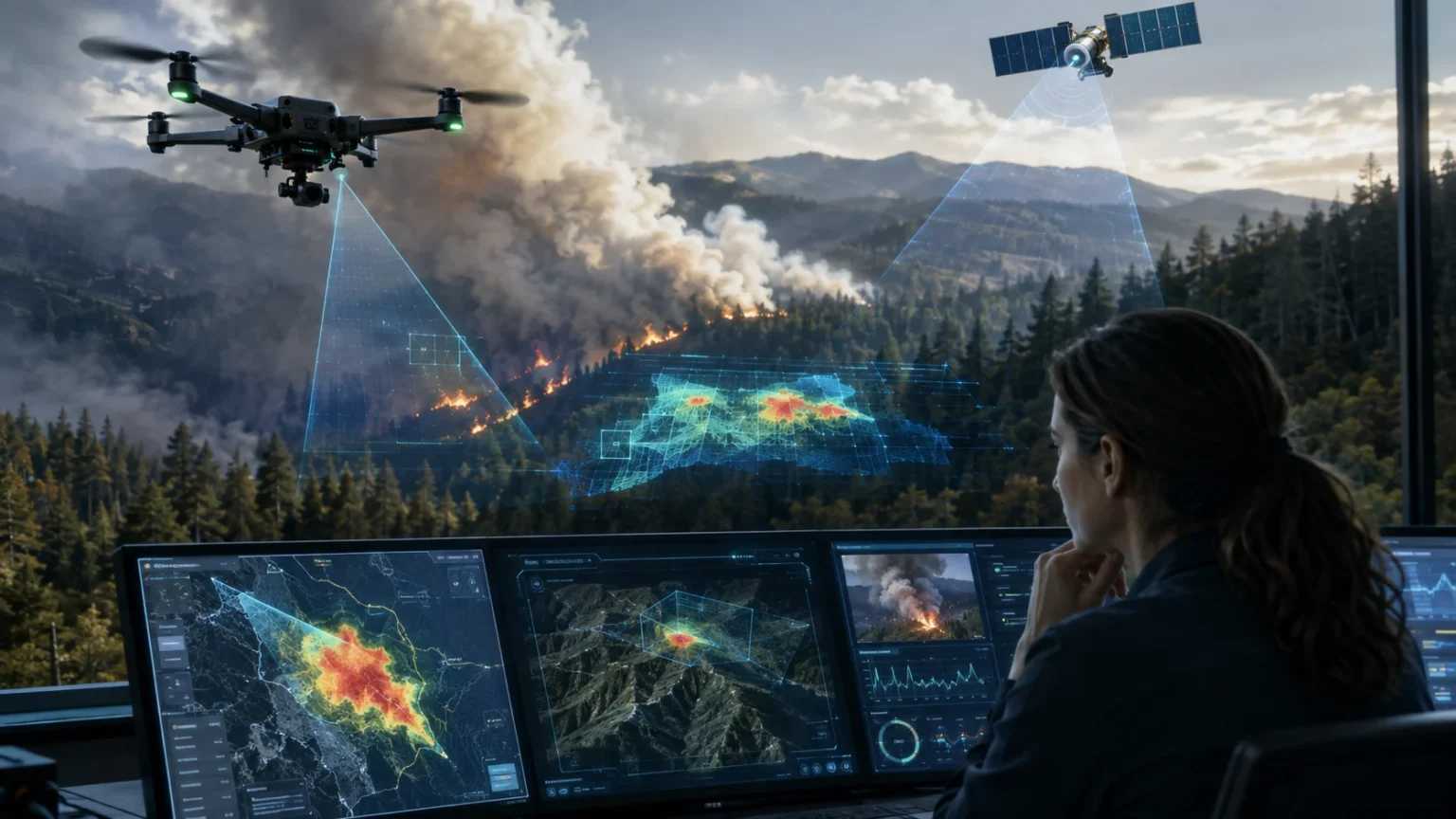

Can AI Help Detect Wildfires?
Wildfires can grow from a small ignition into a dangerous emergency surprisingly quickly, particularly when dry vegetation, strong winds, and extreme heat create favorable burning conditions. That makes early detection one of the most important parts of wildfire management. Artificial intelligence is increasingly giving emergency teams another set of digital eyes by analyzing satellite imagery, camera feeds, weather information, and sensor data for possible signs of fire.
So, can AI help detect wildfires? Yes. AI-powered wildfire detection systems can recognize unusual heat signatures, smoke plumes, changing landscapes, and other patterns associated with fires. Instead of requiring people to continuously inspect enormous amounts of imagery, machine learning algorithms can automatically screen incoming data and highlight areas that may require immediate attention from trained professionals.
The technology is already moving beyond experimental research. NOAA’s Next Generation Fire System uses artificial intelligence with satellite observations to detect and track fires, including monitoring fire intensity and growth in near real time. NASA also provides near-real-time satellite fire information through systems such as FIRMS, showing how increasingly advanced Earth-observation technology can improve awareness of active fires.
AI does not replace firefighters, dispatchers, meteorologists, or wildfire specialists. Instead, its greatest value comes from helping these professionals find potential fires earlier, understand changing conditions, and prioritize where resources may be needed. As satellite technology, thermal cameras, remote sensors, and machine learning improve together, AI could become an increasingly important part of wildfire early-warning systems around the world.
How Does AI Detect a Wildfire?
AI wildfire detection begins with information collected from technologies capable of observing the environment. Satellite cameras, infrared sensors, mountaintop cameras, weather stations, drones, and ground-based devices can continuously produce data. Artificial intelligence algorithms analyze this information for patterns associated with wildfire activity, such as unusual temperatures, visible smoke, rapidly changing vegetation, or infrared signatures indicating intense heat.
Machine learning systems are trained using examples that help them recognize what fire and smoke look like under different conditions. Training datasets may contain images of real fires alongside images of clouds, fog, dust, industrial smoke, sunlight, and other objects that could cause confusion. By learning the differences, the algorithm becomes better at identifying potential fire events without treating every unusual visual feature as an emergency.
When an AI system notices something suspicious, it can generate an alert or flag the location for further review. Depending on the technology being used, an alert may include coordinates, imagery, estimated fire size, temperature information, or other observations. Human operators can then compare the alert with additional data and determine whether firefighters or other emergency resources should investigate the location.
The main advantage is speed combined with scale. A person cannot continuously inspect every forest, grassland, mountain, and remote wilderness area at the same time. AI-powered monitoring systems can analyze huge streams of information automatically, allowing fire agencies to focus attention on the areas where algorithms detect unusual activity while still relying on professional verification before major decisions are made.
Why Early Wildfire Detection Matters So Much
A wildfire can behave very differently depending on wind, terrain, fuel moisture, vegetation, temperature, and humidity. Under severe conditions, even a relatively small ignition can become difficult to control. Detecting a fire while it remains small can potentially give response teams more options than discovering the same incident after flames have spread across a much larger landscape.
Traditional wildfire detection can involve reports from residents, lookout towers, aircraft, patrol teams, and emergency calls. These methods remain extremely valuable, but they may not immediately reveal fires in isolated locations where few people are present. Remote monitoring technologies can help cover some of these gaps by continuously observing landscapes that would otherwise be difficult to watch.
Faster detection can also improve situational awareness. Knowing approximately where a fire has started allows agencies to examine nearby roads, homes, forests, critical infrastructure, and communities. Emergency teams can then evaluate potential risks while meteorologists and fire behavior specialists assess how weather and environmental conditions could influence the direction and speed of the fire.
AI therefore matters not because it can magically stop wildfires but because information received earlier can be more useful. Minutes can sometimes affect how quickly a potential ignition is investigated. When automated detection works alongside satellite monitoring, emergency communications, trained observers, and firefighting expertise, authorities gain another tool for understanding developing threats.
How Satellites and AI Work Together to Find Fires
Satellites are among the most useful tools for monitoring wildfires because they can observe extremely large regions from space. Some instruments detect visible smoke, while infrared sensors can identify thermal anomalies created by unusually hot areas on Earth’s surface. AI can process these observations automatically, helping distinguish potential fires from the enormous amount of normal environmental information captured every day.
NOAA’s geostationary satellites provide frequent observations that support wildfire monitoring, while its AI-enabled Next Generation Fire System scans satellite imagery to identify potential fires and monitor changes. In July 2026, NOAA described the system being used to scan imagery rapidly as satellites monitored wildfire activity in the western United States.
NASA’s Fire Information for Resource Management System, commonly known as FIRMS, also provides near-real-time active-fire information from satellite observations, including instruments such as MODIS and VIIRS. These technologies identify thermal anomalies and make fire information available for researchers, land managers, emergency agencies, and others who need to understand where burning may be occurring.
Satellite detection does have limitations. Clouds, smoke, the timing of satellite passes, sensor resolution, and other environmental conditions can affect what instruments observe. For that reason, satellite-based wildfire detection becomes even more valuable when combined with ground cameras, weather measurements, aircraft observations, local reports, and professional interpretation instead of being treated as a completely independent solution.
How AI Cameras Can Spot Smoke in Remote Areas
AI-powered camera networks provide another method for detecting wildfires before they become extremely large. Cameras positioned on towers, mountains, utility infrastructure, or other elevated locations can continuously observe forests and surrounding landscapes. Computer vision algorithms analyze the live imagery and search for patterns that resemble smoke or other early visual evidence of fire.
Traditional cameras still require someone to notice the problem. Adding AI changes the process because software can inspect images continuously, even while operators are focused elsewhere. When the system identifies a suspicious plume, it can flag the relevant section of an image and direct human attention toward it, reducing the amount of routine monitoring people need to perform manually.
Computer vision must distinguish wildfire smoke from visually similar conditions. Clouds, fog, dust, steam, haze, and changing sunlight can potentially resemble smoke, especially when viewed from long distances. Well-designed detection systems therefore require varied training data and repeated real-world testing so that algorithms become better at separating actual fire indicators from harmless environmental events.
Camera systems also complement satellites because they observe landscapes from a different perspective. A satellite provides broad regional coverage, while a strategically positioned ground camera may offer a detailed view of a specific forest or community. Combining both sources can strengthen wildfire situational awareness by giving response teams multiple ways to investigate the same potential incident.
Can AI Detect Wildfires Using Heat Instead of Smoke?
Wildfires generate thermal energy, making infrared sensing an important method of detecting them. Thermal cameras and satellite instruments measure forms of infrared radiation that humans cannot see directly. When a particular location becomes significantly hotter than its surroundings, computer algorithms can analyze that thermal anomaly and determine whether it resembles the pattern expected from an active fire.
Heat-based detection can sometimes reveal burning that is difficult to identify in ordinary photographs. This is particularly useful at night, when visible-light imagery becomes less effective. Thermal monitoring can also help researchers observe active fire fronts through conditions where ordinary images provide less information, although heavy clouds and other environmental factors can still create limitations for certain sensors.
AI helps because high-temperature readings do not always indicate wildfires. Industrial facilities, controlled burns, volcanoes, exposed hot surfaces, and other sources may produce thermal signals. Machine learning models can combine temperature patterns with location, surrounding vegetation, previous observations, weather data, and other features to estimate whether a particular anomaly deserves closer investigation.
NASA’s wildfire monitoring resources already rely heavily on thermal satellite observations, while newer airborne sensors continue expanding the amount of information available to responders. In March 2025, NASA’s AVIRIS-3 airborne instrument detected an approximately 120-acre Alabama fire that had not yet been reported to officials, illustrating the value of advanced remote sensing for finding active burns.
How Machine Learning Recognizes Smoke and Flames
Machine learning works by identifying statistical patterns within large datasets. For wildfire detection, researchers can train models using thousands or millions of images containing smoke, flames, vegetation, clouds, buildings, and normal landscapes. The model gradually learns visual characteristics that make wildfire smoke different from other objects, allowing it to estimate whether new images contain potential evidence of fire.
Deep learning approaches, particularly computer vision models, are useful because wildfires rarely look exactly the same. Smoke can appear white, gray, brown, or almost invisible depending on lighting, vegetation, wind, distance, and atmospheric conditions. Flames may be partially hidden by trees or terrain. Flexible AI models can examine many image features simultaneously instead of depending on one simple visual rule.
Temporal information can make detection stronger. Instead of examining only a single photograph, an AI system may compare multiple frames and determine whether a plume is expanding or moving in a way that resembles smoke. Detecting change over time can reduce confusion caused by permanent landscape features and help the system recognize events that are actively developing.
However, computer vision predictions are probabilities rather than unquestionable facts. A model might mistake fog for smoke or fail to identify a difficult fire scene. High-quality wildfire systems therefore combine AI predictions with additional information and human review, especially when an alert could influence emergency deployments, evacuations, or decisions that affect public safety.
How AI Uses Weather Data to Estimate Wildfire Risk
Detecting an existing fire is only one application of artificial intelligence. Researchers can also use machine learning to analyze conditions that make fires more likely to ignite or spread. Temperature, humidity, rainfall, wind, soil moisture, drought, vegetation dryness, lightning, and historical fire activity can all contribute valuable information about wildfire danger.
AI models can combine these variables across large geographic areas and identify patterns associated with increased fire risk. For example, extended dry conditions may reduce vegetation moisture, while strong winds could make a newly started fire spread quickly. An algorithm can continuously process changing weather information and help analysts recognize areas where several dangerous factors are occurring together.
These systems should not be confused with predictions that a fire will definitely occur at a precise location and time. Wildfire ignition can be caused by lightning, power infrastructure, machinery, campfires, arson, and numerous other factors that may be impossible to predict exactly. Risk models are better understood as tools that indicate where conditions deserve additional attention.
Forecasting and detection can nevertheless work together. If an AI system identifies both extremely high fire danger and an unusual thermal or smoke signal in the same area, emergency personnel may have stronger reasons to investigate quickly. This combination of environmental forecasting and real-time monitoring could make future wildfire early-warning platforms increasingly useful for resource planning.
Can Drones Use AI to Detect Wildfires?
Drones can carry visible-light cameras, thermal sensors, and other instruments capable of gathering detailed information about forests and active fires. AI software can analyze the imagery captured during these flights, helping identify hot spots, smoke, burned vegetation, and changes around the fire perimeter. This makes drones potentially valuable for both wildfire detection and ongoing incident monitoring.
One advantage is mobility. Fixed cameras observe the landscape from specific positions, while drones can be deployed toward areas requiring closer inspection when conditions and regulations permit. They can provide detailed aerial views without necessarily requiring a crewed aircraft for every observation, although professional wildfire aviation operations involve strict safety considerations.
During active fires, drones may also help map locations where heat remains after visible flames have decreased. These hot spots can matter because burning material may later reignite or spread. Combining thermal imagery with AI-assisted analysis can help teams process aerial information faster and potentially highlight places that require additional examination by qualified personnel.
Drones are not appropriate everywhere or at every time. Unauthorized aircraft can create serious hazards around firefighting aviation, and weather, battery life, communication range, smoke, regulations, and terrain can limit operations. AI-enabled drones are therefore most useful when integrated into professionally managed wildfire response systems rather than independently flown into emergency zones.
How AI Can Help Track a Fire After It Starts
Detecting ignition is only the beginning of wildfire management. Once a fire becomes active, responders need to understand where it is moving, how intensely different areas are burning, and which communities or infrastructure could become threatened. AI can analyze repeated satellite, camera, aircraft, and sensor observations to help track these changes over time.
Computer models can compare newer imagery with earlier observations and estimate how the fire perimeter has changed. Thermal information may show where burning is most intense, while weather data can help analysts understand conditions influencing the fire’s movement. Combining these information streams creates a more detailed picture than relying on a single observation source.
NOAA says its Next Generation Fire System can monitor fire growth and intensity in near real time, illustrating how automated satellite analysis is evolving beyond simply spotting an initial hot location. Systems capable of tracking changes can give emergency teams additional situational awareness as fires develop across large or difficult-to-access landscapes.
Fire behavior remains highly complex, however. Wind shifts, terrain, vegetation, fuel conditions, and firefighting activities can rapidly change what happens on the ground. AI-generated maps and predictions therefore support rather than replace incident commanders and fire behavior specialists who combine technological information with field observations and operational experience.
Can AI Predict Where a Wildfire Will Spread?
Artificial intelligence can contribute to models that estimate possible wildfire movement by analyzing information about terrain, wind, vegetation, moisture, temperature, and previous fire behavior. Machine learning can discover relationships within historical and simulated fire datasets, helping researchers improve models that estimate how rapidly flames may travel under particular conditions.
Terrain matters because fires often behave differently on slopes than on flat ground. Vegetation also influences how much combustible material is available, while wind can push flames and embers toward new areas. An AI-assisted forecasting system can combine these factors across a digital map and continuously update calculations when environmental observations change.
NASA has been developing research such as its Wildfire Digital Twin project, which combines advanced modeling, artificial intelligence, and rapidly delivered data to improve forecasting of fires and smoke. The broader objective is to give wildfire managers faster, higher-resolution information about dynamic fire conditions.
Predicted fire spread should always be treated as a scenario rather than a certainty. Weather can change suddenly, burning conditions can vary over short distances, and embers can start spot fires ahead of the main perimeter. AI can improve decision-support tools, but experienced wildfire professionals still need to interpret predictions and account for uncertainty.
How AI Helps Reduce False Wildfire Alarms
A wildfire detection system that sends constant false alarms can quickly become less useful. Operators may spend valuable time investigating harmless clouds, dust, steam, sunlight, industrial heat, or controlled fires. Reducing false positives is therefore an important challenge when artificial intelligence is used for automated fire and smoke monitoring.
Machine learning can improve accuracy by studying many examples of both actual fires and situations that resemble them. Instead of simply asking whether an image contains something gray that looks like smoke, advanced models can analyze shape, movement, texture, location, heat, weather conditions, and changes between consecutive images before assigning a probability.
Combining several sensors can provide another layer of verification. A camera may detect a suspicious plume while satellite infrared data shows no unusual heat, for example. Alternatively, thermal activity, visible smoke, and dangerous weather conditions occurring together may increase confidence that an alert represents a genuine fire rather than an ordinary environmental feature.
No system can eliminate every incorrect prediction. The practical goal is to make automated alerts accurate enough that they help rather than overwhelm emergency personnel. Human verification, multiple data sources, continuous model improvement, and feedback from real wildfire incidents can all contribute to more dependable AI-assisted detection over time.
FireSat and the Next Generation of AI Wildfire Detection
One of the notable developments in wildfire monitoring is FireSat, a satellite constellation designed specifically to detect and track fires. The system combines purpose-built satellite sensors with artificial intelligence so that smaller fires can potentially be discovered before they grow into major incidents. The project reflects the broader movement toward specialized Earth-observation infrastructure for wildfire management.
The first FireSat satellite launched in March 2025, and additional satellites were launched in July 2026. Google says the planned full constellation is intended to identify fires approximately 5 by 5 meters in size and provide frequent updates when fully deployed.
Early FireSat imagery released in 2025 demonstrated detection of multiple active fires in Australia’s Northern Territory using mid-wave infrared observations. The system’s developers envision combining frequent satellite coverage and AI analysis to provide fire agencies with useful information while also building a long-term dataset that researchers can use to study fire behavior.
Projects such as FireSat show where wildfire detection technology is heading: smaller detectable fires, more frequent observations, automated analysis, and greater integration between satellite data and emergency response. These capabilities will still need continued real-world testing, reliable communication infrastructure, responsible deployment, and effective integration with existing firefighting operations.
What Are the Biggest Benefits of AI Wildfire Detection?
The most obvious advantage is faster awareness. Automated systems do not need to become tired or distracted while examining continuous streams of data. They can scan satellite imagery, camera feeds, and sensor measurements repeatedly and highlight unusual patterns as soon as they appear, potentially shortening the time between ignition and detection.
Another major advantage is coverage. Large forests and remote wilderness areas may have relatively few residents or observers who can report smoke. Satellites and automated camera systems can watch extensive regions simultaneously, helping agencies monitor places that would be difficult or expensive to patrol continuously using only people or aircraft.
AI can also reduce information overload. Modern wildfire teams may receive data from satellites, weather stations, sensors, aircraft, cameras, and field crews. Machine learning can filter this information and highlight potentially important changes, allowing professionals to concentrate attention on locations and events that require closer investigation rather than manually reviewing every incoming measurement.
Finally, AI can help connect detection with broader wildfire intelligence. The same system may eventually combine ignition alerts, fire intensity, weather forecasts, vegetation conditions, smoke movement, and fire-spread modeling. Providing these insights through one coordinated decision-support environment could help emergency teams understand both where a fire exists and what it might do next.
What Are the Limitations of AI Wildfire Detection?
AI wildfire detection depends heavily on the quality of the data it receives. Cameras may struggle in darkness or heavy weather, satellite observations can be affected by clouds and sensor limitations, and ground sensors cover only the locations where they have been installed. An algorithm cannot accurately analyze environmental information that its underlying technology fails to capture.
False positives and missed detections remain another concern. Smoke can resemble clouds, hot industrial facilities can resemble thermal fire signals, and small fires may remain hidden beneath tree cover. Machine learning reduces some of these problems but cannot guarantee perfect results, making human verification an important part of public-safety applications.
Connectivity can also present difficulties in remote landscapes. A sensor may detect a potential fire but still need reliable communications to transmit information to emergency agencies. Rugged mountains, limited cellular networks, power interruptions, and damaged infrastructure can affect how quickly information travels from detection technology to the people responsible for responding.
Finally, technology cannot solve the wildfire problem by itself. Prevention, vegetation management, community planning, evacuation preparation, resilient infrastructure, firefighter training, responsible land use, and public awareness remain essential. AI is most useful as one layer within a larger wildfire management strategy rather than as a substitute for those measures.
Could AI Help Protect Firefighters?
Wildland firefighting is dangerous because conditions can change rapidly. Fire crews must consider wind, terrain, vegetation, heat, smoke, lightning, fire intensity, and the possibility that flames may move unexpectedly. Better information can help incident managers maintain awareness of developing hazards and adjust operations when conditions become more dangerous.
AI-powered satellite and thermal monitoring can help identify changes beyond what individual firefighters can see from ground level. If a fire front intensifies or a new hot spot develops elsewhere, remote sensing systems may provide additional information that can be incorporated into operational maps and briefings.
Artificial intelligence can also support weather-related safety. Lightning forecasting, fire-weather analysis, and smoke modeling provide important context for crews working around active incidents. NOAA has highlighted AI tools used alongside satellite observations for wildfire detection and lightning awareness, demonstrating how machine learning can support multiple elements of fire-weather decision-making.
Still, firefighter safety decisions cannot be delegated entirely to algorithms. Conditions observed directly in the field, communication among crews, established safety procedures, incident command structures, and professional judgment remain fundamental. AI’s role is to provide additional information that may help those professionals make better-informed decisions.
Can AI Prevent Wildfires?
AI generally cannot prevent an ignition simply by detecting it. Lightning can strike, equipment can malfunction, and human activities can start fires even when sophisticated monitoring systems are operating. What AI can potentially do is improve prevention planning by identifying risk patterns and helping agencies focus resources on places where dangerous conditions are developing.
Machine learning can analyze weather, vegetation dryness, historical fires, topography, infrastructure, and other variables to identify regions with elevated wildfire risk. Utilities, governments, land managers, and emergency agencies can use these assessments alongside established fire-danger systems to guide inspections, vegetation management, public warnings, or other preventive actions.
AI may also help detect hazardous changes before a fire occurs. Researchers are exploring ways to analyze vegetation conditions, drought stress, electrical infrastructure, and other environmental factors that can contribute to ignition risk. Identifying those patterns does not eliminate uncertainty, but it can provide additional evidence for targeted prevention programs.
The most realistic goal is therefore risk reduction rather than complete wildfire prevention. Artificial intelligence can help people understand where danger is increasing, detect fires earlier when they occur, and provide information about their development. Preventing destructive wildfire disasters still requires coordinated action from communities, land managers, governments, infrastructure operators, and emergency services.
Will AI Replace Human Wildfire Lookouts?
AI cameras and satellites can monitor landscapes continuously, which may lead some people to wonder whether human wildfire observers will become unnecessary. In practice, humans still provide skills that automated systems cannot completely duplicate, including interpreting unusual conditions, communicating local context, confirming uncertain reports, and making judgment-based decisions when information is incomplete.
An algorithm may identify a plume that has a high probability of being smoke, but a trained observer can consider whether prescribed burning, industrial activity, weather conditions, or another local event provides a better explanation. Humans can also communicate directly with emergency teams and adjust observations according to evolving operational needs.
AI is therefore more useful as an extension of human observation. Automated systems can watch thousands of images and flag the few that appear important. People can then investigate those alerts, combine them with local knowledge, and decide whether action is necessary. This division of work allows technology and human expertise to complement each other.
The future of wildfire detection will likely involve networks rather than one replacement technology. Satellites, cameras, aircraft, drones, sensors, weather models, public reports, fire lookouts, dispatchers, and artificial intelligence can all contribute different information. Combining them intelligently can create a stronger early-warning system than depending on any single source alone.
The Future of AI in Wildfire Detection
Wildfire monitoring is moving toward faster, more connected systems capable of processing information almost as soon as it is collected. Improvements in satellite resolution, thermal sensing, machine learning, cloud computing, communications, and environmental monitoring are making it increasingly possible to detect and analyze changing fire conditions across enormous geographic areas.
The next major improvement may come from combining many technologies into one intelligent monitoring network. An AI platform could receive satellite imagery, camera observations, lightning information, vegetation moisture, wind forecasts, thermal measurements, and local sensor data simultaneously. Instead of viewing each source separately, algorithms could evaluate the complete situation and determine which locations deserve immediate attention.
More specialized satellites are also emerging. FireSat’s ongoing deployment and NOAA’s operational development of AI-assisted fire-monitoring capabilities demonstrate that automated wildfire detection is moving closer to everyday emergency management rather than remaining only a research concept.
The most successful systems will still need trust from the people who use them. Alerts must arrive quickly, contain understandable information, minimize false alarms, and work reliably during real emergencies. AI becomes valuable not simply because its algorithms are sophisticated, but because it delivers useful information to firefighters and communities when that information can make a meaningful difference.
Final Thoughts: Can AI Really Help Detect Wildfires?
So, can AI help detect wildfires? The evidence increasingly suggests that it can. Artificial intelligence can analyze satellite observations, thermal imagery, camera feeds, weather information, and other environmental data to recognize patterns associated with active fires. Automated analysis gives emergency agencies another way to discover potential ignitions and monitor rapidly changing conditions.
Its greatest strength is the ability to process enormous quantities of information continuously. AI can scan landscapes that people cannot watch every second, flag suspicious smoke or heat, and organize incoming observations for human review. Modern systems from organizations including NOAA and NASA already demonstrate how advanced satellite data can strengthen wildfire monitoring and situational awareness.
However, AI wildfire detection should not be viewed as an automatic replacement for existing emergency systems. Algorithms can make mistakes, sensors have limitations, and conditions on the ground can change rapidly. Firefighters, meteorologists, dispatchers, emergency managers, and wildfire specialists remain responsible for interpreting information and deciding how to respond.
The future is therefore about collaboration between technology and people. AI can provide speed, scale, and pattern recognition, while trained professionals provide experience, local knowledge, judgment, and accountability. Used together, these capabilities could help communities identify dangerous fires earlier, understand them faster, and respond with better information.
Frequently Asked Questions
How quickly can AI detect a wildfire?
Detection speed depends on the technology, sensor coverage, communication network, and fire conditions. Some modern satellite and camera systems are designed to identify potential fires within minutes and quickly alert human operators.
Can AI detect a wildfire before someone sees smoke?
In some situations, yes. Infrared and thermal sensors can identify unusual heat signatures that may indicate burning, allowing an AI system to flag potential fire activity even when visible smoke is difficult to observe.
Can satellites detect small wildfires?
Yes, although detection capability varies by satellite and sensor resolution. Newer specialized systems are being developed to identify much smaller fires than many traditional space-based monitoring technologies.
Is AI wildfire detection completely accurate?
No. AI can produce false alarms or occasionally miss a fire because of clouds, terrain, sensor limitations, smoke conditions, or unusual environmental features. Human verification and multiple data sources remain important.
Can AI predict where wildfires will happen?
AI can estimate wildfire risk by analyzing weather, vegetation, drought, terrain, and historical fire patterns. It usually cannot predict the exact location and time of every future ignition with certainty.